Category:Mill Road, Cambridge
Jump to navigation
Jump to search
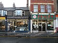
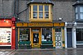
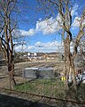
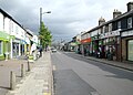
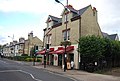
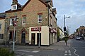
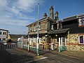
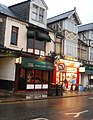
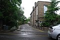
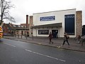
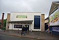
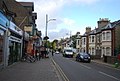
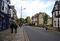
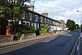
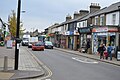
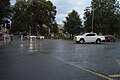
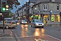
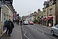
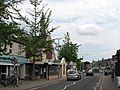
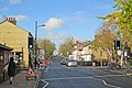
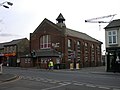
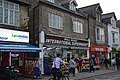
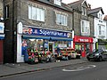
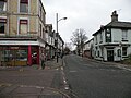
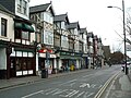
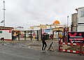
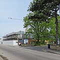
English: Mill Road is a street in southeast Cambridge, England. It runs southeast from near to Parker's Piece, at the junction with Gonville Place, East Road, and Parkside. It crosses the main railway line and links to the city's ring road (the A1134). It passes through the wards of Petersfield and Romsey, which are divided by the railway line. It is a busy, cosmopolitan street home to many independent businesses, churches, a Hindu temple and the city's mosque.
street in southeast Cambridge, England  | |||||
| Upload media | |||||
| Instance of | |||||
|---|---|---|---|---|---|
| Location | Cambridge, Cambridgeshire, East of England, England | ||||
 | |||||
Subcategories
This category has the following 4 subcategories, out of 4 total.
Media in category "Mill Road, Cambridge"
The following 200 files are in this category, out of 255 total.
(previous page) (next page)-

-

-
 -2021-05-10 Mill Road, Cambridge.jpg 819 × 1,024; 1.06 MB
-
 101, Ditchburn Place - geograph.org.uk - 5889731.jpg 1,024 × 681; 238 KB
-
 2017 09 18 romsey mill cambridge 2.jpg 4,000 × 3,000; 742 KB
-
 A funeral procession on Mill Road - geograph.org.uk - 4176249.jpg 1,024 × 683; 962 KB
-
 A summer evening on Mill Road (geograph 3569096).jpg 1,024 × 885; 224 KB
-
 A walk down Mill Road (1) - geograph.org.uk - 1632819.jpg 640 × 480; 109 KB
-
 A walk down Mill Road (10) - geograph.org.uk - 1633064.jpg 640 × 480; 96 KB
-
 A walk down Mill Road (11) - geograph.org.uk - 1633048.jpg 640 × 480; 93 KB
-
 A walk down Mill Road (12) - geograph.org.uk - 1633036.jpg 640 × 480; 58 KB
-
 A walk down Mill Road (13) - geograph.org.uk - 1633016.jpg 640 × 480; 74 KB
-
 A walk down Mill Road (14) - geograph.org.uk - 1633009.jpg 640 × 480; 80 KB
-
 A walk down Mill Road (15) - geograph.org.uk - 1632997.jpg 640 × 480; 97 KB
-
 A walk down Mill Road (16) - geograph.org.uk - 1632990.jpg 640 × 480; 86 KB
-
 A walk down Mill Road (17) - geograph.org.uk - 1632988.jpg 640 × 480; 98 KB
-
 A walk down Mill Road (18) - geograph.org.uk - 1632985.jpg 640 × 480; 100 KB
-
 A walk down Mill Road (19) - geograph.org.uk - 1632977.jpg 640 × 480; 98 KB
-
 A walk down Mill Road (2) - geograph.org.uk - 1633098.jpg 640 × 480; 110 KB
-
 A walk down Mill Road (20) - geograph.org.uk - 1632856.jpg 640 × 480; 103 KB
-
 A walk down Mill Road (21) - geograph.org.uk - 1632851.jpg 640 × 480; 98 KB
-
 A walk down Mill Road (22) - geograph.org.uk - 1632846.jpg 640 × 480; 101 KB
-
 A walk down Mill Road (23) - geograph.org.uk - 1632843.jpg 640 × 480; 95 KB
-
 A walk down Mill Road (24) - geograph.org.uk - 1632841.jpg 640 × 480; 104 KB
-
 A walk down Mill Road (25) - geograph.org.uk - 1632839.jpg 640 × 480; 95 KB
-
 A walk down Mill Road (26) - geograph.org.uk - 1632837.jpg 640 × 480; 86 KB
-
 A walk down Mill Road (27) - geograph.org.uk - 1632836.jpg 640 × 480; 87 KB
-
 A walk down Mill Road (28) - geograph.org.uk - 1632835.jpg 640 × 480; 114 KB
-
 A walk down Mill Road (29) - geograph.org.uk - 1632832.jpg 640 × 480; 109 KB
-
 A walk down Mill Road (3) - geograph.org.uk - 1633097.jpg 640 × 480; 107 KB
-
 A walk down Mill Road (30) - geograph.org.uk - 1632827.jpg 640 × 480; 93 KB
-
 A walk down Mill Road (4) - geograph.org.uk - 1633092.jpg 640 × 480; 106 KB
-
 A walk down Mill Road (5) - geograph.org.uk - 1633090.jpg 640 × 480; 104 KB
-
 A walk down Mill Road (6) - geograph.org.uk - 1633088.jpg 640 × 480; 99 KB
-
 A walk down Mill Road (7) - geograph.org.uk - 1633086.jpg 640 × 480; 86 KB
-
 A walk down Mill Road (8) - geograph.org.uk - 1633084.jpg 640 × 480; 116 KB
-
 A walk down Mill Road (9) - geograph.org.uk - 1633082.jpg 640 × 480; 112 KB
-
 After the fire (1) - geograph.org.uk - 1048694.jpg 640 × 480; 68 KB
-
 After the fire (2) - geograph.org.uk - 1048706.jpg 640 × 480; 59 KB
-
 Al-Amin, Mill Rd - geograph.org.uk - 5889695.jpg 1,024 × 681; 183 KB
-
 Andrew Northrop Butchers, Mill Road - geograph.org.uk - 1558401.jpg 640 × 480; 93 KB
-
 Arjuna Wholefoods, 12 Mill Rd (geograph 6027829).jpg 1,024 × 680; 170 KB
-
 Bharat Bhavan Cambridge - geograph.org.uk - 395915.jpg 640 × 480; 76 KB
-
 Bharat Bhavan, Mill Road - geograph.org.uk - 5359371.jpg 1,600 × 1,052; 313 KB
-
 Bridge mural on Mill Road, Cambridge, England.jpg 640 × 480; 77 KB
-
 Brookfields Hospital - geograph.org.uk - 1866674.jpg 1,600 × 1,200; 820 KB
-
 Builders Merchants Yard - geograph.org.uk - 5460742.jpg 640 × 426; 94 KB
-
 Building on the Mill Road Depot site - geograph.org.uk - 6084398.jpg 819 × 1,024; 1.34 MB
-
 Bus stop and shelter on Mill Road - geograph.org.uk - 4706503.jpg 640 × 480; 79 KB
-

-
 Cambridge Bed Centre - geograph.org.uk - 5641008.jpg 1,024 × 683; 625 KB
-
 Cambridge City Branch Library - geograph.org.uk - 3776342.jpg 640 × 430; 90 KB
-
 Cambridge City Branch Library - geograph.org.uk - 3776347.jpg 640 × 452; 74 KB
-
 Cambridge Kitchens and Bathrooms - geograph.org.uk - 4805802.jpg 1,600 × 1,126; 799 KB
-
 Cambridge, on Mill Road - geograph.org.uk - 5506074.jpg 1,024 × 731; 771 KB
-
 Cambridge- on Mill Road (geograph 5708631).jpg 1,024 × 1,024; 1.07 MB
-
 Carlos BBQ, Mill Rd - geograph.org.uk - 5889728.jpg 1,024 × 681; 164 KB
-
 Chimney stacks, Mill Road - geograph.org.uk - 1070871.jpg 640 × 480; 56 KB
-
 Chimneys mill rf.jpg 3,264 × 2,448; 1.57 MB
-
 Cho Mee, Mill Rd - geograph.org.uk - 5889693.jpg 1,024 × 681; 166 KB
-
 Christmas Day on Mill Road (2) - geograph.org.uk - 1109372.jpg 640 × 480; 104 KB
-
 Christmas Day on Mill Road (3) - geograph.org.uk - 1109383.jpg 640 × 480; 103 KB
-
 Christmas Day on Mill Road (4) - geograph.org.uk - 1109389.jpg 640 × 480; 105 KB
-
 Christmas Day on Mill Road (5) - geograph.org.uk - 1109395.jpg 640 × 480; 99 KB
-
 Christmas Day on Mill Road (6) - geograph.org.uk - 1109406.jpg 640 × 480; 113 KB
-
 Christmas Day on Mill Road (7) - geograph.org.uk - 1109435.jpg 640 × 480; 90 KB
-
 Cleared area, Mill Road - geograph.org.uk - 3229224.jpg 1,600 × 1,200; 557 KB
-
 Cleared area, Mill Road - geograph.org.uk - 3229228.jpg 1,600 × 1,200; 809 KB
-
 Cmglee Cambridge Romsey Mill bike event.jpg 4,800 × 3,200; 1,024 KB
-
 Cmglee Cambridge Romsey Mill bikes.jpg 4,800 × 3,200; 1,024 KB
-
 Cmglee Cambridge Romsey Mill from Coleridge Road.jpg 3,072 × 2,048; 512 KB
-
 Cmglee Cambridge Romsey Mill from Hemingford Road.jpg 3,072 × 2,048; 512 KB
-
 Cmglee Cambridge Romsey Mill from Mill Road.jpg 3,072 × 2,048; 512 KB
-
 Cmglee Cambridge Romsey Mill from ped xing.jpg 3,072 × 2,048; 1,024 KB
-
 Costa, Mill Rd - geograph.org.uk - 3809703.jpg 640 × 430; 68 KB
-
 Costa, Mill Rd - geograph.org.uk - 5889727.jpg 1,024 × 681; 152 KB
-
 Council vehicle depot off Mill Road - geograph.org.uk - 4565556.jpg 2,560 × 1,920; 1.23 MB
-
 Council vehicle depot off Mill Road - geograph.org.uk - 4565559.jpg 2,560 × 1,920; 1.15 MB
-
 Curry Queen, Mill Rd - geograph.org.uk - 4033226.jpg 494 × 640; 78 KB
-
 Cutlacks, Mill Road - geograph.org.uk - 4565575.jpg 2,560 × 1,920; 1.05 MB
-
 Cycle King, Mill Road - geograph.org.uk - 707332.jpg 640 × 480; 74 KB
-
 Digit Al comes to Mill Road - geograph.org.uk - 2230584.jpg 1,024 × 768; 211 KB
-
 Ditchburn Gardens - geograph.org.uk - 5889706.jpg 1,024 × 681; 259 KB
-
 Ditchburn Gardens - geograph.org.uk - 5889730.jpg 1,024 × 681; 221 KB
-
 Ditchburn Gardens - geograph.org.uk - 6034853.jpg 1,024 × 681; 186 KB
-
 Ditchburn Place - geograph.org.uk - 4040419.jpg 640 × 430; 82 KB
-
 Ditchburn Place - geograph.org.uk - 4904893.jpg 640 × 426; 96 KB
-
 Ditchburn Place - geograph.org.uk - 5889709.jpg 1,024 × 681; 195 KB
-
 Earl of Beaconsfield - geograph.org.uk - 3776270.jpg 640 × 430; 78 KB
-

-
 Floral decoration in Mill Road - geograph.org.uk - 891012.jpg 480 × 640; 81 KB
-
 Former bath house, Cambridge - geograph.org.uk - 4454118.jpg 894 × 600; 206 KB
-

-
 Former public baths - geograph.org.uk - 5351054.jpg 640 × 426; 58 KB
-
 Garden on Mill Rd - geograph.org.uk - 3809674.jpg 640 × 430; 79 KB
-
 Gardens, Mill Rd - geograph.org.uk - 4040416.jpg 640 × 430; 73 KB
-
 Gardens, Mill Rd - geograph.org.uk - 4370259.jpg 640 × 426; 72 KB
-
 Houses on Mill Road - geograph.org.uk - 4706507.jpg 640 × 480; 59 KB
-
 International Food Store - geograph.org.uk - 6034857.jpg 1,024 × 681; 157 KB
-
 Kymmoy noodle bar, Mill Road - geograph.org.uk - 854159.jpg 640 × 480; 77 KB
-
 Londis, Mill Rd - geograph.org.uk - 4956315.jpg 640 × 426; 58 KB
-
 Maurizio Dining, Mill Rd - geograph.org.uk - 6027839.jpg 1,024 × 681; 125 KB
-
 Mickey Flynn's - geograph.org.uk - 3776360.jpg 640 × 430; 55 KB
-
 Mickey Flynn's American Pool - geograph.org.uk - 3229234.jpg 1,600 × 1,200; 624 KB
-
 Mickey Flynn's closed, Mill Road - geograph.org.uk - 5613203.jpg 1,600 × 1,200; 245 KB
-
 Micky Flynns - geograph.org.uk - 4034285.jpg 640 × 430; 59 KB
-
 Mill Rd (geograph 3809712).jpg 640 × 430; 69 KB
-
 Mill Rd (geograph 3809716).jpg 640 × 430; 72 KB
-
 Mill Rd (geograph 4040429).jpg 640 × 430; 72 KB
-
 Mill Rd (geograph 4370284).jpg 640 × 426; 88 KB
-
 Mill Rd - geograph.org.uk - 3910668.jpg 640 × 430; 52 KB
-
 Mill Rd - geograph.org.uk - 3998410.jpg 640 × 430; 94 KB
-
 Mill Rd - geograph.org.uk - 4034282.jpg 640 × 430; 84 KB
-
 Mill Rd - geograph.org.uk - 4813632.jpg 640 × 426; 79 KB
-
 Mill Rd - geograph.org.uk - 4816131.jpg 640 × 426; 75 KB
-
 Mill Rd - geograph.org.uk - 4849959.jpg 640 × 426; 69 KB
-
 Mill Rd - geograph.org.uk - 4849964.jpg 640 × 426; 66 KB
-
 Mill Rd - geograph.org.uk - 4904895.jpg 640 × 547; 88 KB
-
 Mill Rd - geograph.org.uk - 4952431.jpg 640 × 426; 51 KB
-
 Mill Rd - geograph.org.uk - 4956299.jpg 640 × 426; 44 KB
-
 Mill Rd - geograph.org.uk - 4956300.jpg 640 × 426; 42 KB
-
 Mill Rd - geograph.org.uk - 4956314.jpg 640 × 426; 58 KB
-
 Mill Rd - geograph.org.uk - 4956320.jpg 640 × 426; 53 KB
-
 Mill Rd - geograph.org.uk - 4982765.jpg 640 × 426; 83 KB
-
 Mill Rd - geograph.org.uk - 5351045.jpg 640 × 426; 66 KB
-
 Mill Rd - geograph.org.uk - 5889701.jpg 1,024 × 681; 169 KB
-
 Mill Rd - geograph.org.uk - 5889717.jpg 1,024 × 681; 130 KB
-
 Mill Rd - geograph.org.uk - 6027817.jpg 1,024 × 681; 178 KB
-
 Mill Rd - geograph.org.uk - 6034876.jpg 1,024 × 681; 177 KB
-
 Mill Road (geograph 4370262).jpg 640 × 426; 78 KB
-
 Mill Road (geograph 4370291).jpg 640 × 426; 71 KB
-
 Mill Road - geograph.org.uk - 4514578.jpg 1,600 × 1,052; 479 KB
-
 Mill Road and Brookfields Hospital - geograph.org.uk - 5624482.jpg 819 × 1,024; 799 KB
-
 Mill Road and St Philip's - geograph.org.uk - 2969596.jpg 1,024 × 772; 1,011 KB
-
 Mill Road and the railway bridge - geograph.org.uk - 4248576.jpg 1,024 × 682; 954 KB
-
 Mill Road Baptist Church - geograph.org.uk - 4956316.jpg 640 × 426; 54 KB
-
 Mill Road Baptist Church - geograph.org.uk - 707372.jpg 640 × 480; 59 KB
-
 Mill Road Baths - geograph.org.uk - 5889696.jpg 1,024 × 681; 168 KB
-
 Mill Road Bridge - geograph.org.uk - 3610615.jpg 1,024 × 768; 216 KB
-
 Mill Road Bridge - geograph.org.uk - 4610967.jpg 640 × 458; 105 KB
-
 Mill Road Bridge closure - from the west - geograph.org.uk - 6214275.jpg 1,024 × 1,024; 1.07 MB
-

-
 Mill Road Broadway - geograph.org.uk - 2848092.jpg 1,024 × 702; 799 KB
-
 Mill Road building site - geograph.org.uk - 5140605.jpg 1,024 × 780; 895 KB
-
 Mill Road Cambridge map.png 890 × 572; 428 KB
-
 Mill road church.jpg 3,264 × 2,448; 2.67 MB
-
 Mill Road closed - geograph.org.uk - 6214105.jpg 819 × 1,024; 1.07 MB
-
 Mill Road Depot site entrance - geograph.org.uk - 6057662.jpg 1,024 × 1,024; 1.06 MB
-
 Mill Road Gardens - geograph.org.uk - 4813618.jpg 640 × 426; 110 KB
-
 Mill Road Gardens - geograph.org.uk - 5222870.jpg 640 × 426; 109 KB
-
 Mill Road Gardens - geograph.org.uk - 5884992.jpg 1,024 × 681; 151 KB
-
 Mill Road International Supermarket - geograph.org.uk - 5889724.jpg 1,024 × 681; 188 KB
-
 Mill Road International Supermarket - geograph.org.uk - 6027834.jpg 1,024 × 681; 182 KB
-
 Mill Road International Supermarket, Christmas Day 2016 (geograph 5234250).jpg 1,024 × 768; 200 KB
-
 Mill Road mural, Cambridge - geograph.org.uk - 4451778.jpg 906 × 600; 236 KB
-
 Mill Road mural, Cambridge - geograph.org.uk - 4451787.jpg 906 × 600; 177 KB
-
 Mill Road on a January afternoon (geograph 5644223).jpg 1,024 × 1,024; 1.13 MB
-
 Mill Road Post Office - geograph.org.uk - 707435.jpg 640 × 480; 91 KB
-
 Mill Road railway bridge at five to nine - geograph.org.uk - 5460652.jpg 1,024 × 768; 797 KB
-
 Mill Road revisited (3) (geograph 6713941).jpg 1,600 × 1,200; 444 KB
-
 Mill Road shops (geograph 4469537).jpg 1,600 × 1,200; 582 KB
-
 Mill Road sunset - geograph.org.uk - 5854613.jpg 640 × 480; 344 KB
-
 Mill Road Tesco (at last) - geograph.org.uk - 1463504.jpg 640 × 480; 85 KB
-
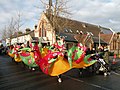
 Mill Road Winter Fair - panoramio.jpg 4,320 × 3,240; 3.09 MB
-
 Mill Road Winter Fair 2009.jpg 1,200 × 1,600; 1.04 MB
-
 Mill Road Winter Fair 2013 - geograph.org.uk - 3775854.jpg 480 × 640; 133 KB
-
 Mill Road Winter Fair 2013 - geograph.org.uk - 3775900.jpg 640 × 480; 119 KB
-
 Mill Road Winter Fair 2013 - geograph.org.uk - 3775950.jpg 640 × 640; 143 KB
-
 Mill Road, a snow shower - geograph.org.uk - 5691994.jpg 1,024 × 1,024; 1.25 MB
-
 Mill Road, after a fire - geograph.org.uk - 6214263.jpg 683 × 1,024; 1.01 MB
-
 Mill Road, Cambridge, England 01.jpg 640 × 480; 84 KB
-
 Mill Road, Cambridge, England in 2007.jpg 640 × 479; 110 KB
-
 Mill Road, Christmas Day - geograph.org.uk - 1090745.jpg 640 × 480; 70 KB
-
 Mill Road, damaged by fire - geograph.org.uk - 6225362.jpg 768 × 1,024; 1.06 MB
-
 Mill Road, fire damage - geograph.org.uk - 6214115.jpg 819 × 1,024; 1.01 MB
-
 Mill Road, fire damage - geograph.org.uk - 6246807.jpg 1,024 × 1,024; 1.28 MB
-
 Mill Road, housing development - geograph.org.uk - 5503580.jpg 1,024 × 731; 807 KB
-
 Mill Road, lights changing - geograph.org.uk - 3804209.jpg 1,200 × 857; 1.22 MB
-
 Mill Road, new street lights - geograph.org.uk - 3233592.jpg 923 × 1,024; 356 KB
-

-
 Mill Road, rebuilding St Philip's Church - geograph.org.uk - 2695037.jpg 1,024 × 790; 991 KB
-
 Mill Road, Romsey Town - geograph.org.uk - 751213.jpg 640 × 480; 81 KB
-
 Mill Road, roof-truss delivery - geograph.org.uk - 5366795.jpg 1,024 × 683; 626 KB
-
 Mill Road, site entrance - geograph.org.uk - 5503577.jpg 1,024 × 1,024; 1.07 MB
-
 Mill Road, the mosque taking shape - geograph.org.uk - 5641065.jpg 1,024 × 732; 779 KB
-
 Mill Road, waiting for the lights - geograph.org.uk - 3690162.jpg 1,024 × 758; 946 KB
-
 Molly Dancers on Mill Road - geograph.org.uk - 2189725.jpg 1,024 × 768; 282 KB
-
 Monday morning on Mill Road - geograph.org.uk - 3869955.jpg 1,200 × 911; 1.23 MB
-
 More floral decorations in Mill Road - geograph.org.uk - 891014.jpg 480 × 640; 84 KB
-
 Moroccan Restaurant - geograph.org.uk - 6034863.jpg 1,024 × 681; 187 KB
-
 Morris dancers in Mill Road - geograph.org.uk - 1606552.jpg 640 × 480; 101 KB
-
 New and closed shops, Mill Road - geograph.org.uk - 4805786.jpg 1,600 × 1,200; 688 KB
-
 New and old street lights at Mill Road Broadway - geograph.org.uk - 3233585.jpg 1,024 × 739; 263 KB
-
 New houses on the Mill Road Depot site - geograph.org.uk - 6246742.jpg 1,024 × 819; 894 KB
-
 New housing on Mill Road - geograph.org.uk - 5366803.jpg 1,024 × 1,024; 1.21 MB
-
 New housing on Mill Road - geograph.org.uk - 5503584.jpg 1,024 × 732; 874 KB
-
 New housing on Mill Road - geograph.org.uk - 5797608.jpg 1,024 × 682; 764 KB
-
 New housing on the Mill Road Depot site - geograph.org.uk - 6214270.jpg 1,024 × 1,024; 1.06 MB
-
 Nip In, Mill Rd - geograph.org.uk - 6027835.jpg 1,024 × 681; 113 KB
-
 Ocean Supermarket, Mill Rd - geograph.org.uk - 6027842.jpg 1,024 × 681; 170 KB


.jpg)
_-_geograph.org.uk_-_1632819.jpg)
_-_geograph.org.uk_-_1633064.jpg)
_-_geograph.org.uk_-_1633048.jpg)
_-_geograph.org.uk_-_1633036.jpg)
_-_geograph.org.uk_-_1633016.jpg)
_-_geograph.org.uk_-_1633009.jpg)
_-_geograph.org.uk_-_1632997.jpg)
_-_geograph.org.uk_-_1632990.jpg)
_-_geograph.org.uk_-_1632988.jpg)
_-_geograph.org.uk_-_1632985.jpg)
_-_geograph.org.uk_-_1632977.jpg)
_-_geograph.org.uk_-_1633098.jpg)
_-_geograph.org.uk_-_1632856.jpg)
_-_geograph.org.uk_-_1632851.jpg)
_-_geograph.org.uk_-_1632846.jpg)
_-_geograph.org.uk_-_1632843.jpg)
_-_geograph.org.uk_-_1632841.jpg)
_-_geograph.org.uk_-_1632839.jpg)
_-_geograph.org.uk_-_1632837.jpg)
_-_geograph.org.uk_-_1632836.jpg)
_-_geograph.org.uk_-_1632835.jpg)
_-_geograph.org.uk_-_1632832.jpg)
_-_geograph.org.uk_-_1633097.jpg)
_-_geograph.org.uk_-_1632827.jpg)
_-_geograph.org.uk_-_1633092.jpg)
_-_geograph.org.uk_-_1633090.jpg)
_-_geograph.org.uk_-_1633088.jpg)
_-_geograph.org.uk_-_1633086.jpg)
_-_geograph.org.uk_-_1633084.jpg)
_-_geograph.org.uk_-_1633082.jpg)
_-_geograph.org.uk_-_1048694.jpg)
_-_geograph.org.uk_-_1048706.jpg)


.jpg)


.jpg)


_-_geograph.org.uk_-_1109372.jpg)
_-_geograph.org.uk_-_1109383.jpg)
_-_geograph.org.uk_-_1109389.jpg)
_-_geograph.org.uk_-_1109395.jpg)
_-_geograph.org.uk_-_1109406.jpg)
_-_geograph.org.uk_-_1109435.jpg)


.jpg)
.jpg)
.jpg)
.jpg)


.jpg)
.jpg)


.jpg)


.jpg)


_(geograph_6713941).jpg)
.jpg)

_-_geograph.org.uk_-_1463504.jpg)


